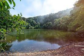
Barva Volcano is an andesitic stratovolcano complex in central Costa Rica, 22 km north of San José, in Heredia Province. On the eastern side of the mountain it has a lake in what was the volcanic crater, called “Laguna de Barva”, and in the western side it has three hills on the top which are called “Las Tres Marías”. It is located in the small agricultural community of Sacramento. Barva Volcano is located approximately 14 miles northeast of the capital of San Jose, and is the highest point in Braulio Carrillo National Park, standing almost 10,000 feet above sea level. The mountain features many lagoons created by the streams and rivers that run into the craters caused by previous eruptions. Barva Volcano deepest lagoon, which shares the same name as the mountain, is approximately 28 feet deep.

Barva has several eruptive centres at its summit and many parasitic cones on its flanks. Its three principal summits visible from the Central Valley give it the common local name of Las Tres Marías (The Three Marys) Barva Volcano is actually one of three mountainous peaks that make up Las Tres Marías, or The Three Marys. This is the name given to the series of mountains visible in Heredia’s Central Valley. While Barva has remained dormant for much of recent history, the mountain itself has around a dozen eruptive sites where the pressure of the molten rock beneath the surface forced its way out over tens of thousands of years.
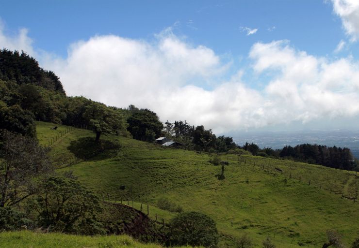
One of the reasons Barva is less frequently visited than its more famous counterparts is that the volcano is somewhat difficult to access. Though it lies just 14 miles northeast of the capital city of San Jose, the trip to the volcano site is not an easy one. The most common way to reach Barva is to begin by driving, taking a bus or hiring a driver to take you to Sacramento. There are no more paved roads beyond Sacramento, so you’ll need to either hike or use an off-road vehicle to complete your trip to Barva. The paths are rocky, seldom maintained and riddled with potholes, so prepare for a very bumpy ride if you choose to drive to your destination.
The giant like volcano is hidden under the green long trees and grass land, each spot is cover but from a distance you can see the lump of it and base it off how tall and wide it really is. It’s not erupted in a while for almost 5000 years, the last eruption was around 4000 bc which is very long ago but sooner or later there always has to be a pop in it.